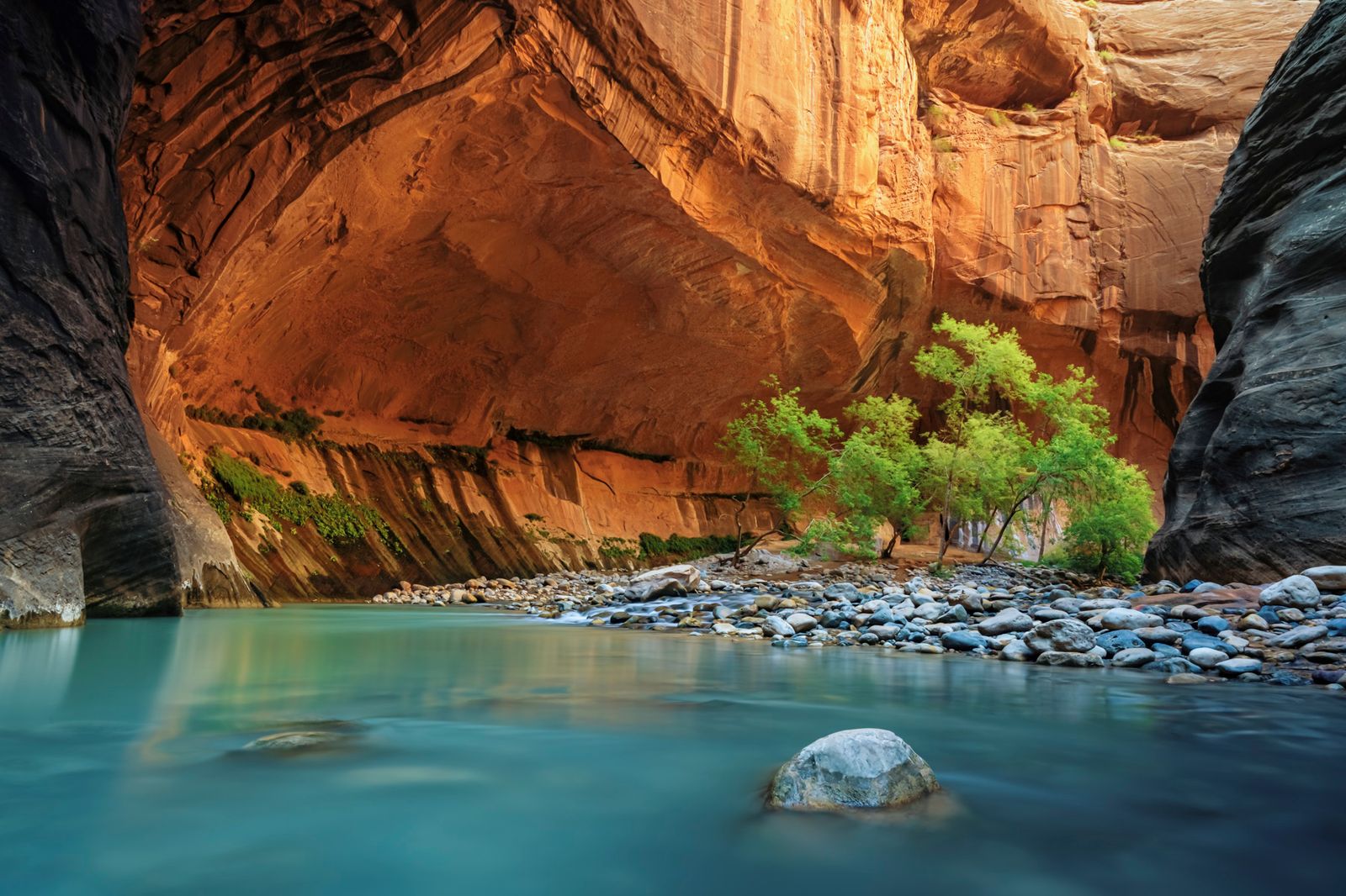
Zion National Park has more than 90 miles of trail, and most first-time visitors hike about four of them. That is not a criticism — Angels Landing, The Narrows, Emerald Pools, and Canyon Overlook are famous for a reason. But the park rewards a closer look, whether this is your first trip or your third: quieter trails inside Zion Canyon that most visitors walk past, and a whole second landscape in the Kolob Canyons and Kolob Terrace sections that many people never see at all.
This guide covers both. Start with the classic trails if this is your first visit. If you have already done Angels Landing and The Narrows, skip to the trails beyond the classics further down — Observation Point, The Subway, Kolob Arch, and the West Rim Trail. Not sure where to start? Try our Zion Hike Picker tool — answer a few questions about fitness level, time, and what you want to see, and it narrows the list for you.
The Classic First-Timer Trails
Angels Landing
Difficulty: Strenuous · Distance: 5.4 miles (8.7 km) round trip · Elevation Gain: 1,488 feet (453 meters)
Angels Landing is Zion's most iconic and most demanding popular hike. The trail climbs steep switchbacks (Walter's Wiggles) and crosses a narrow ridge called the Hogsback before the final half-mile, where chains bolted into the rock assist hikers along an exposed spine to the summit. The reward is a panoramic view of Zion Canyon from above that few other trails in the park can match.
A permit is required year-round for the chain section beyond Scout Lookout — see our full Angels Landing permit guide for lottery details and dates. Hiking to Scout Lookout itself does not require a permit and is a worthwhile turnaround point for anyone uneasy about the exposure ahead. This hike is not recommended for those with a fear of heights or young children.
The Narrows
Difficulty: Moderate to Strenuous · Distance: Up to 16 miles (25.7 km) round trip, depending on route · Elevation Gain: Minimal
The Narrows is a hike through the river itself — the Virgin River is the trail for most of its length, with towering canyon walls rising on either side. Most visitors do the bottom-up day hike from the Temple of Sinawava, wading as far upstream as time and conditions allow with no permit required. The top-down route from Chamberlain's Ranch is a 16-mile overnight or long-day hike that does require a wilderness permit.
Sturdy water shoes and a walking stick are essential for the uneven riverbed, and rental packages are available in Springdale for both. Always check the flash flood forecast at the Visitor Center before starting — the canyon narrows to as little as 20 feet wide in places, and conditions can change fast.
Emerald Pools
Difficulty: Easy to Moderate · Distance: Varies by route · Elevation Gain: Varies by route
The Emerald Pools Trail is one of the best family options in the park, with several connected routes leading to pools and seasonal waterfalls. The Lower Emerald Pool Trail is a paved, mostly flat path suitable for nearly all ages and fitness levels. The Middle and Upper Emerald Pools trails climb higher and are rockier, with better views of the surrounding cliffs for hikers who want more of a workout.
Canyon Overlook
Difficulty: Easy · Distance: 1 mile (1.6 km) round trip · Elevation Gain: 163 feet (50 meters)
The Canyon Overlook Trail starts near the east entrance of the Zion–Mt. Carmel Tunnel, making it an easy add-on for anyone driving that route. The short climb leads to sweeping views of the West Temple, the Towers of the Virgin, and the Streaked Wall — a serious payoff for one mile of walking.
Quieter Trails Worth the Detour
Riverside Walk
Difficulty: Easy · Distance: 2.2 miles (3.5 km) round trip · Elevation Gain: 57 feet (17 meters)
Riverside Walk, also called the Gateway to the Narrows, is a paved, accessible path following the Virgin River beneath Zion Canyon's cliffs. It is the easiest way to experience the canyon's scale without technical terrain, and it doubles as the approach trail for anyone continuing into The Narrows itself.
Watchman Trail
Difficulty: Moderate · Distance: 3.1 miles (5 km) round trip · Elevation Gain: 368 feet (112 meters)
The Watchman Trail starts near the Visitor Center and climbs switchbacks to a loop with interpretive signs on the park's geology and ecology, finishing with views of the Watchman peak and the valley below. Because it starts at the park entrance rather than deeper in the canyon, it sees noticeably fewer hikers than the shuttle-stop trails. Currently closed for repairs as of this writing (closed since August 31, 2026, no confirmed reopening date) — check nps.gov/zion for current status before planning around it.
Weeping Rock
Difficulty: Easy · Distance: 0.4 miles (0.6 km) round trip · Elevation Gain: 98 feet (30 meters)
A short walk to a rock alcove where groundwater seeps through the sandstone, creating a "weeping" curtain of water. The trail passes lush hanging gardens and interpretive signage, and its short distance makes it accessible for nearly anyone with limited time or mobility.
Pa'rus Trail
Difficulty: Easy · Distance: 3.5 miles (5.6 km) round trip · Elevation Gain: 50 feet (15 meters)
Pa'rus is the park's only paved, wheelchair-accessible trail and the only trail where dogs are allowed. Starting at the South Campground, it follows the Virgin River with cliff views the whole way — a good option for families, cyclists, and anyone traveling with a pet.
Timber Creek Overlook
Difficulty: Easy · Distance: 1 mile (1.6 km) round trip · Elevation Gain: 100 feet (30 meters)
In the Kolob Canyons section, this easy family hike winds through juniper and pinyon pine forest to a scenic overlook of Timber Creek, the Kolob Terrace, and the Pine Valley Mountains — a quiet, uncrowded alternative to the main canyon's overlooks.
Beyond the Classics: Trails Worth Coming Back For
The trails above cover a first visit well. The trails below are what a second or third trip to Zion is for — quieter, farther from the shuttle stops, and largely absent from anyone's first search for "best Zion hikes."
Observation Point via East Mesa
Difficulty: Strenuous · Distance: 7.0 miles (11.3 km) round trip · Elevation Gain: About 700 feet (213 meters)
Observation Point delivers the view that makes Angels Landing visitors wonder if they picked the wrong trail — it sits above Zion Canyon rather than inside it, with Angels Landing itself visible below and the canyon stretching in both directions. The original East Rim Trail from the Weeping Rock shuttle stop has been closed indefinitely since 2019, after a rockfall deposited an estimated 31,000 tons of rock across nearly a mile of trail.
The current approach is the East Mesa Trail, starting outside the park at a trailhead near the Zion Ponderosa Ranch area, reached via North Fork County Road off UT-9. Parking is limited to 15–20 vehicles, and the final mile of dirt road can become impassable when wet. East Zion Adventures runs a shuttle from the ranch to the trailhead for around $7 per person, which sidesteps both problems. Best accessed April through November.
Kolob Arch and the La Verkin Creek Trail
Difficulty: Strenuous · Distance: 14 miles (22.5 km) round trip · Elevation Gain: 1,000 feet (305 meters)
Kolob Arch sits in the Kolob Canyons section, a 45-minute drive from Springdale into a landscape that feels nothing like Zion Canyon. The La Verkin Creek Trail is the route to one of the largest natural arches in the world, through a high canyon system most Zion visitors never see — most people who do drive out to Kolob Canyons stop at the Timber Creek Overlook and never go further. The full round trip is a day commitment that rewards the effort with genuine solitude.
The West Rim Trail
Difficulty: Strenuous · Distance: 13.6 miles (21.9 km) one way · Elevation Gain: Substantial, with the upper rim near 7,000 feet
The West Rim Trail connects Lava Point, reached by vehicle via Kolob Terrace Road, down to the Grotto shuttle stop on the canyon floor. Day-hikers can walk it from the canyon floor as far as time and legs allow before turning back. Backpackers with overnight permits can camp on the rim and descend into the canyon the next morning. The views across both the canyon and the Kolob Terrace feel entirely disconnected from the crowded shuttle stops below.
The Subway and How Zion's Backcountry Permit System Works
The Subway is the most photographed slot-canyon formation in the park that requires a permit to reach — a tubular, water-carved section of the North Fork of the Virgin River. The bottom-up route from the Left Fork Trailhead covers about 9.5 miles round trip. There is no maintained trail; the approach requires route-finding across open terrain and water crossings that may involve wading. (A top-down route from Wildcat Canyon involves rappelling and technical rope skills — if you are unsure whether you are ready for that version, the bottom-up route is the one to plan for.)
Permits for The Subway and Zion's other backcountry routes are managed through Recreation.gov across three tiers: a seasonal lottery with applications open on the 1st–25th of designated months, a daily lottery applied for two days before your hike with results by 4 PM, and walk-in permits available at the Visitor Center Wilderness Desk the day before or day of. All permits, including lottery wins, must be picked up in person at the Wilderness Desk. The daily quota for The Subway is approximately 80 people across both routes combined, and it is a day-use permit only — no overnight camping. Fees are $6 per application plus $10 per person.
The same backcountry system covers more than The Subway: the 16-mile top-down Narrows route from Chamberlain's Ranch, West Rim overnight camping, Zion Slot, and other designated backcountry zones. Walk-up permits are worth checking even after an unsuccessful lottery — cancellations happen more often than most visitors expect. For the Angels Landing-specific permit system, which runs separately from the backcountry desk, see our Angels Landing permit guide.
Kolob Terrace Road: A Drive That Doubles as a Trailhead
Kolob Terrace Road starts in the small town of Virgin, about 15 miles west of Springdale on Highway 9, and climbs 22 miles north to the Lava Point Overlook at 7,890 feet. It is paved but narrow, crossing a mix of private land, national forest, and park boundary terrain, with views of the western side of the Zion massif that no canyon-floor shuttle stop offers — the drive is worth it even without getting out of the car.
The road accesses trailheads that see a fraction of the canyon's crowds, including Wildcat Canyon and Hop Valley, which the Connector Trail links into a longer high-plateau loop. Lava Point Campground at the road's end is a primitive, first-come-first-served site that runs noticeably cold at night even in midsummer.
One planning note: the lower 14 miles from Virgin stay open year-round, but the upper section past Hop Valley closes seasonally for snow, typically from late fall through May. Confirm current access at nps.gov/zion before planning a trip around Lava Point or the West Rim's north trailhead.
Building Your Trip Around the Right Trails
Zion offers hiking for every fitness level and time budget, from the 15-minute walk to Weeping Rock to the full-day push to Kolob Arch or The Subway. First-time visitors do well sticking to the classic trails above; anyone on a repeat trip should look beyond them, where the crowds thin out fast. Whichever list you're choosing from, check trail conditions and the weather forecast before you go, and pack for the specific trail — water shoes for The Narrows, sun protection for the exposed Kolob routes, layers for anything above 7,000 feet.
Still deciding where to start? Our Zion Hike Picker tool matches trails to your fitness level, available time, and what you want to see. Browse our Hiking section for individual trail guides, or our Beyond Zion section for regional day trips that pair well with a repeat visit.


